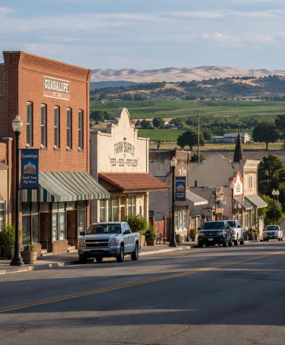
Guadalupe, California
All areas

Guadalupe

Gateway to the Dunes, at Highway 1 and Highway 166

Guadalupe is a small Santa Barbara County city at the junction of Highway 1 and Highway 166, close to the Pacific Ocean and best known today as the gateway to the Guadalupe-Nipomo Dunes.

Search Guadalupe Homes

The story

Life in Guadalupe

Guadalupe sits immediately south of the Santa Maria River, about 8 miles west of Santa Maria and roughly 5 miles east of the ocean, at the intersection of Highway 1 and Highway 166. The city's motto, "Gateway to the Dunes!," reflects its role as the closest town to the Guadalupe-Nipomo Dunes, a National Natural Landmark and one of the largest coastal dune ecosystems in California.

With a population of about 8,000, Guadalupe is economically and socially closely tied to Santa Maria. Its history as an agricultural town and a waystation for Swiss-Italian, Japanese, Chinese, Filipino, Portuguese, and Mexican immigrant communities is preserved by the Rancho de Guadalupe Historical Society.

The city's downtown, bisected by Highway 1 (Guadalupe Street), retains early 20th-century buildings, including the former Far Western Tavern building, once a well-known Santa Maria-style steakhouse and now slated to become a Dunes Center museum annex.

The history

Where it began

The Portolá expedition camped near present-day Guadalupe on September 1, 1769, and expedition member Juan Crespí noted a large lake nearby. The area was part of the Chumash and Purisimeño-speaking peoples' territory before Spanish and later Mexican settlement.

In 1840, the Mexican government granted the roughly 32,000-acre Rancho Guadalupe to Teodoro Arellanes and Diego Olivera for cattle ranching. The townsite of Guadalupe was founded in 1873 and, for about a decade, was the largest settlement in northwestern Santa Barbara County.

Guadalupe formally incorporated on August 3, 1946. The city's historic water tower, built in 1928, was damaged in the 2003 San Simeon earthquake and replaced in 2009.

Living here

The benefits

Walkability

Walkability varies by neighborhood. See current Walk Score®, Transit Score® and Bike Score® ratings.

View scores

Things to Do

  • Guadalupe-Nipomo Dunes Center, a nonprofit museum and visitor center at 1065 Guadalupe Street promoting conservation of the dunes
  • Rancho Guadalupe Dunes Preserve and Rancho Guadalupe Beach, at the western edge of the Guadalupe-Nipomo Dunes complex
  • Rancho de Guadalupe Historical Society Museum, located in the Veterans' Memorial building at 1005 Guadalupe Street

Eat & Drink

  • La Simpatia, a longtime Mexican restaurant on Guadalupe Street
  • The historic Far Western Tavern building, a former steakhouse (1958–2012) now preserved as a historic resource; the restaurant itself relocated to Old Orcutt in Santa Maria

Shopping

  • Small-scale retail along Guadalupe Street (Highway 1) in the compact downtown core

Groceries

  • Local independent markets along Guadalupe Street; residents also commonly shop in nearby Santa Maria for larger supermarkets

Schools

  • Guadalupe Union School District, headquartered at 4465 Ninth Street, operating Guadalupe Early Learning Center and Kermit McKenzie Intermediate School
  • High school students attend schools in the Santa Maria Joint Union High School District, which includes Guadalupe in its boundaries

Hospitals

  • Marian Regional Medical Center in Santa Maria is the nearest major hospital, about 8 miles east of Guadalupe

Transportation

  • Highway 1 runs through the city as Guadalupe Street; Highway 166 provides the route east to Santa Maria and inland toward the San Joaquin Valley
  • The Guadalupe–Santa Maria Amtrak station (on the Pacific Surfliner/Coast Starlight line) serves the area
  • Regional bus service connects Guadalupe to Santa Maria via local transit routes

Thinking about Guadalupe?

Call Felicity for local insight, or browse what’s for sale right now.